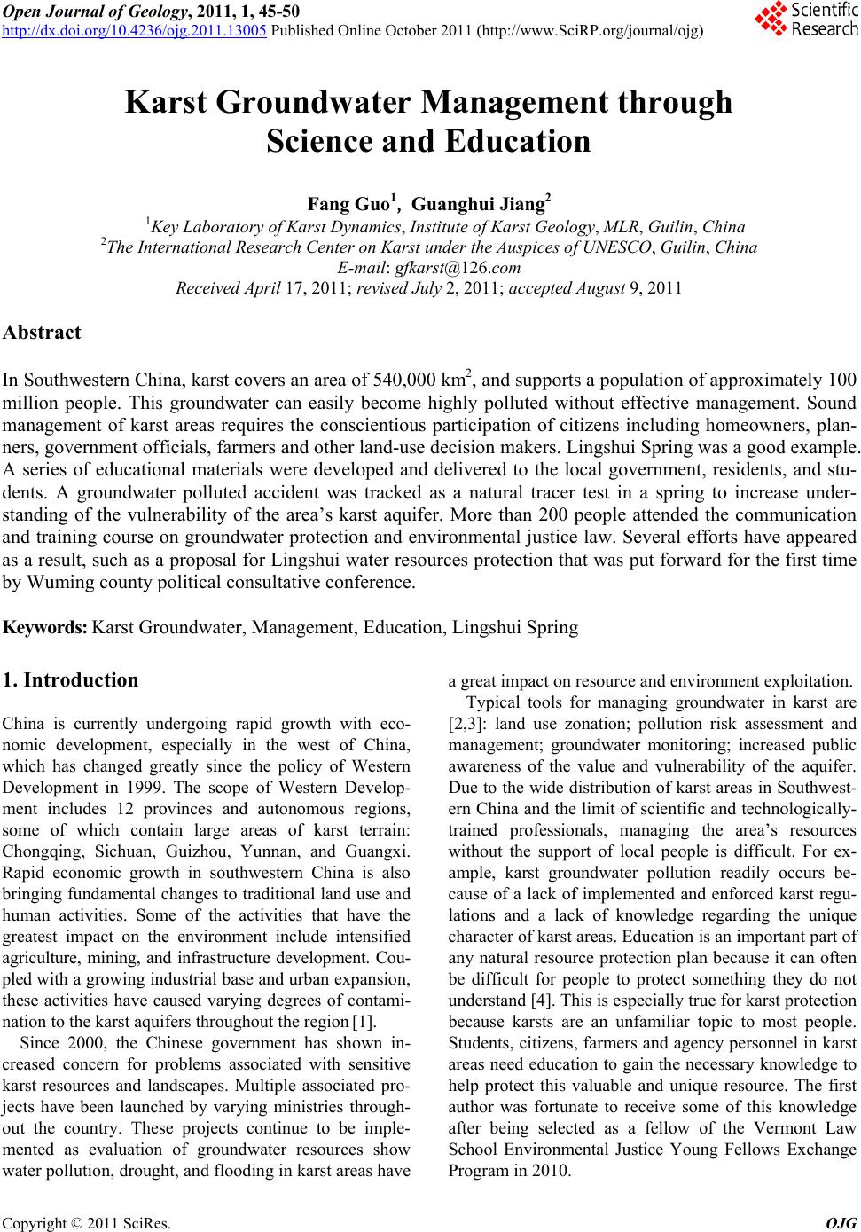
F. GUO ET AL.
Copyright © 2011 SciRes. OJG
48
1970s and 1980s, China deployed a 1:20 million cen-
sus-based regional hydrology study to identify the status
of groundwater in the country. Since 1999, a new round
of land and resources surveys at a 1:5 millionscale was
launched in the southwest and other areas, but to date
only 20 million square kilometers have been completed.
In China, there are only a limited number of institutes
involved in karst research and exploration. These include:
the Institute of Guangxi Geology Prospecting and Ex-
ploitation, Guangxi Hydrogeological Team, Yunnan Bu-
reau of Geology and Mineral Prospecting and Exploita-
tion, Geological Survey of Yunnan Province, Bureau of
Geology and Mineral Exploration and Development of
Guizhou Province, and the Geological Survey of Hunan
Province. Some universities, such as the China Univer-
sity of Geosciences (Wuhan) and Southwest University,
also engage in karst research. The Institute of Karst Ge-
ology is the only institute specifically focused on karst
studies in China. The total number of karst professionals
in the region is only about 10,000 employees. Compared
to the widespread distribution of karst and the large
population size (approximately 10 million people), sci-
entists and technologists are limited, making the man-
agement of karst resources difficult.
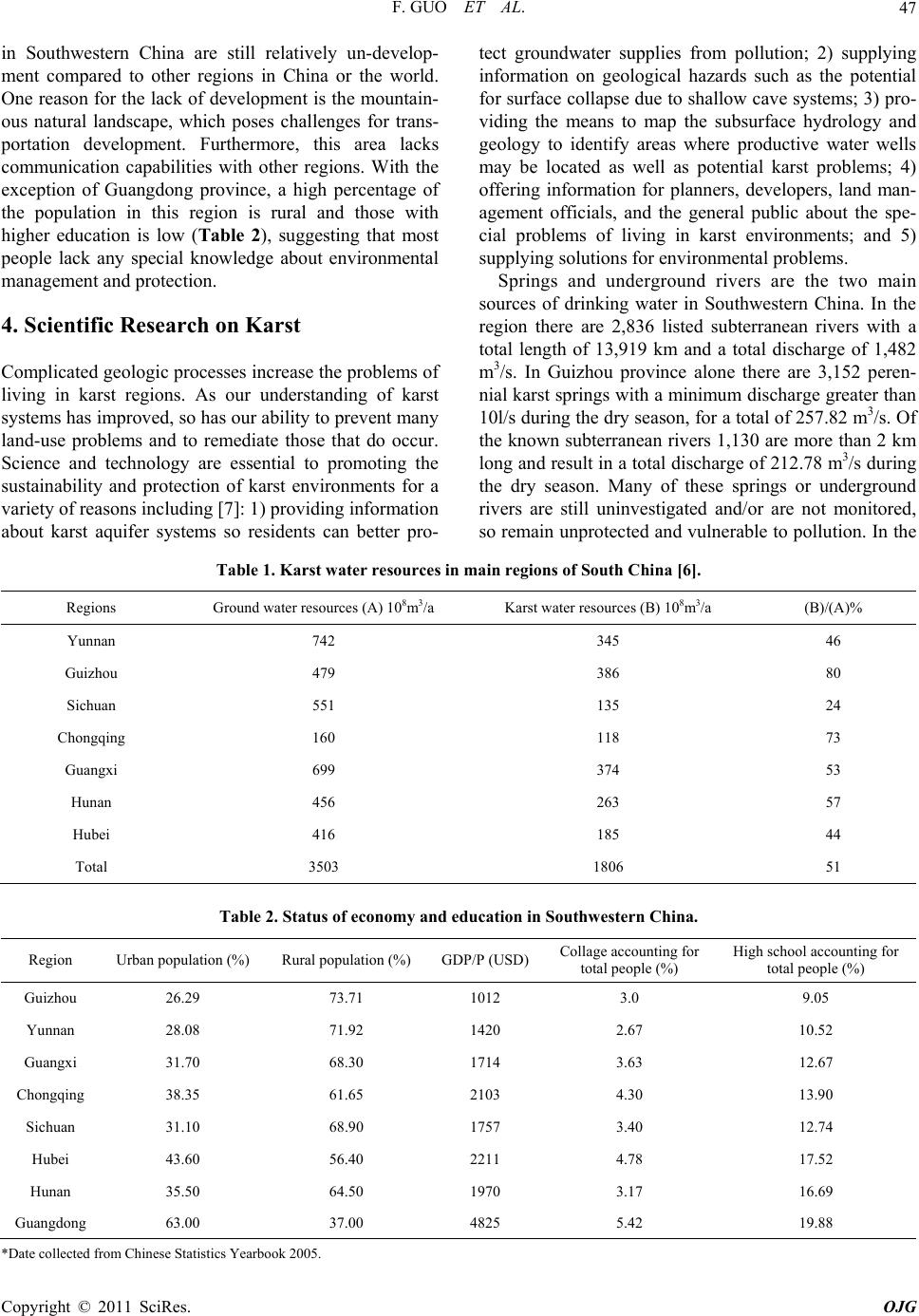
5. Liushui Spring―A Case Study
Lingshui Spring in Wuming County, Nanning City,
Guangxi Zhuang Autonomous Region was selected as
the case study. Lingshui Spring, the former training base
for the Chinese National Swimming Team, is a highly
scenic spot that produces excellent drinking water for
more than 100,000 people. With the establishment of the
Nanning Association of Southeast Asian Nations eco-
nomical garden, more than 200,000 consumers will rely
on the spring by 2025. However, until recently there was
no protection area designated for the spring, so water
quality was likely to continually deteriorate and decline
as agricultural and industrial activities in the spring
catchment increase. For example, NO3
– which is related
to agriculture activities has increased over the past 30
years, while water consumption has also gradually in-
creased, resulting in discharge that has decreased by
nearly 50% compared to that in the dry seasons of 1977
and 1978. The local government and residents are ap-
propriately worried about these problems.
5.1. Public Education
In order to deliver information about the importance of
karst groundwater, how groundwater flows, and how to
protect karst groundwater supplies through regulations,
brochures that serve as calendars were developed and
distributed to Wuming government officials, members of
Wuming county political consultative conference, local
citizens, students, and others. A training and communi-
cation course was held in Wuming County from August
14 to August 16, 2010. The title of this course was:
Training and Communication on Understanding Ground-
water, Protecting Groundwater in Wuming County. In
order to learn about U.S. experiences, two American
scientists with research interests focusing on national and
international informal environmental education efforts
related to karst landscapes, anthropogenic karst distur-
bance, cave environmental education, karst climate change,
and water resources were invited to attend and present.
Two presentations were given during the workshop:
Protecting Karst Systems and Groundwater through Sci-
ence and Education (presented by the visiting U.S. scien-
tists), and Karst Groundwater Protection and Relative
Laws (shown by a Chinese scientist). More than 200
people attended this training and communication work-
shop, including the vice head of county, director from
Wuming county government, all members from the
Wuming county political consultative conference, the
Bureau of Water Resource, the Bureau of Environmental
Protection, the Bureau of Forestry, the Bureau of Land
and Resources, Bureau of Housing and Urban-Rural De-
velopment, Bureau of Tourism, Wuming Water Com-
pany, representatives from local citizens, and graduate
students from Southwest University, China University of
Geosciences, Guilin University of Technology, and
Guangxi Normal University.
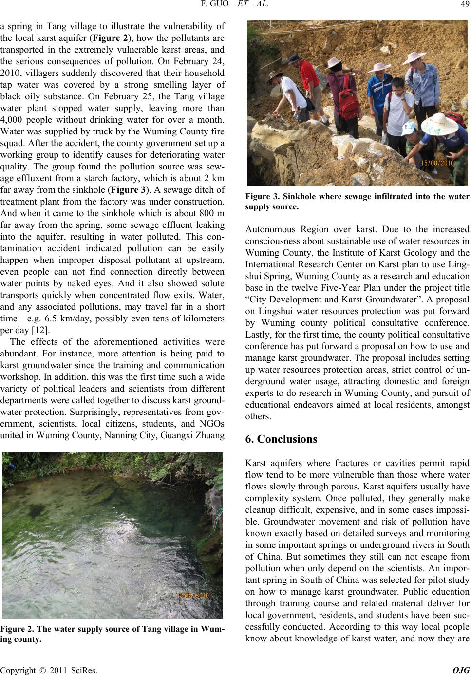
5.2. Natural Tracer Test
Groundwater tracers include any substance that can be-
come dissolved or suspended in water, or attached to the
water molecule, and recovered or measured from a water
sample that can be used to trace the source of groundwa-
ter in terms of its specific or relative location and time of
recharge. Groundwater tracers can include both artifi-
cially introduced and naturally occurring substances [8].
Groundwater tracing with artificial tracers involves add-
ing a label to the groundwater that can be identified if
that same water is sampled at a different location. Natu-
ral tracing involves the use of naturally occurring com-
ponents of a water sample to determine information
about the source and age of the sample. The most com-
monly used natural tracers are isotopes and chemical
compounds that originate in the atmosphere and become
incorporated in the rainfall the recharges an aquifer
[9-11]. Groundwater tracing as a science has been in
practice for more than a century but has been slow to
become accepted in karst areas in China largely because
complexity of karst water system. A fieldtrip was lead to