Protecting the Groundwater Environment of Tulkarem City of Palestine from Industrial and Domestic Pollution
38
on the concept and principles of Integrated Water
Resources Management (IWRM);
Improving coordination and communication among
municipal departments to properly assign and address
environmental hazards.
○ Using GIS to share information among different
departments and provide a common base of in-
formation for dialogue.
○ Learning from other experiences in the region
through cooperation and exchanging ideas and in-
formation.
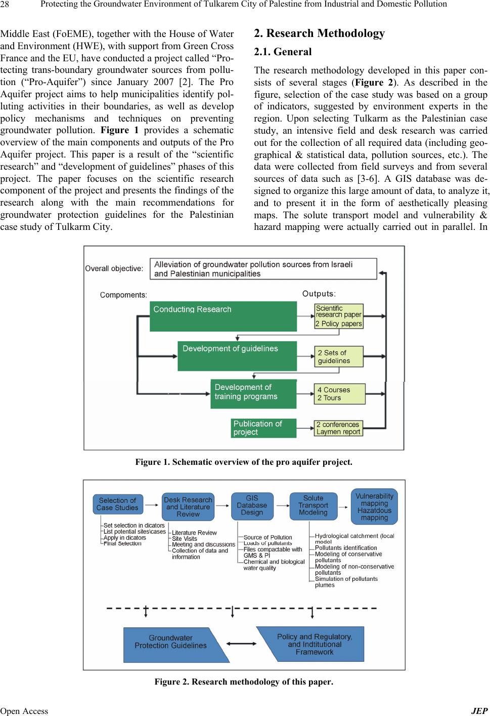
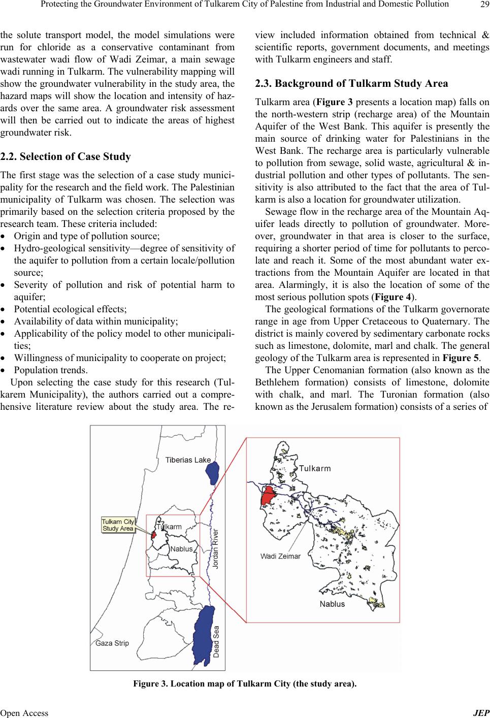
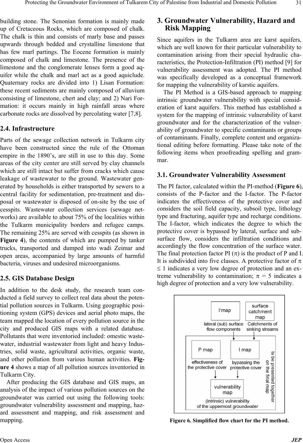
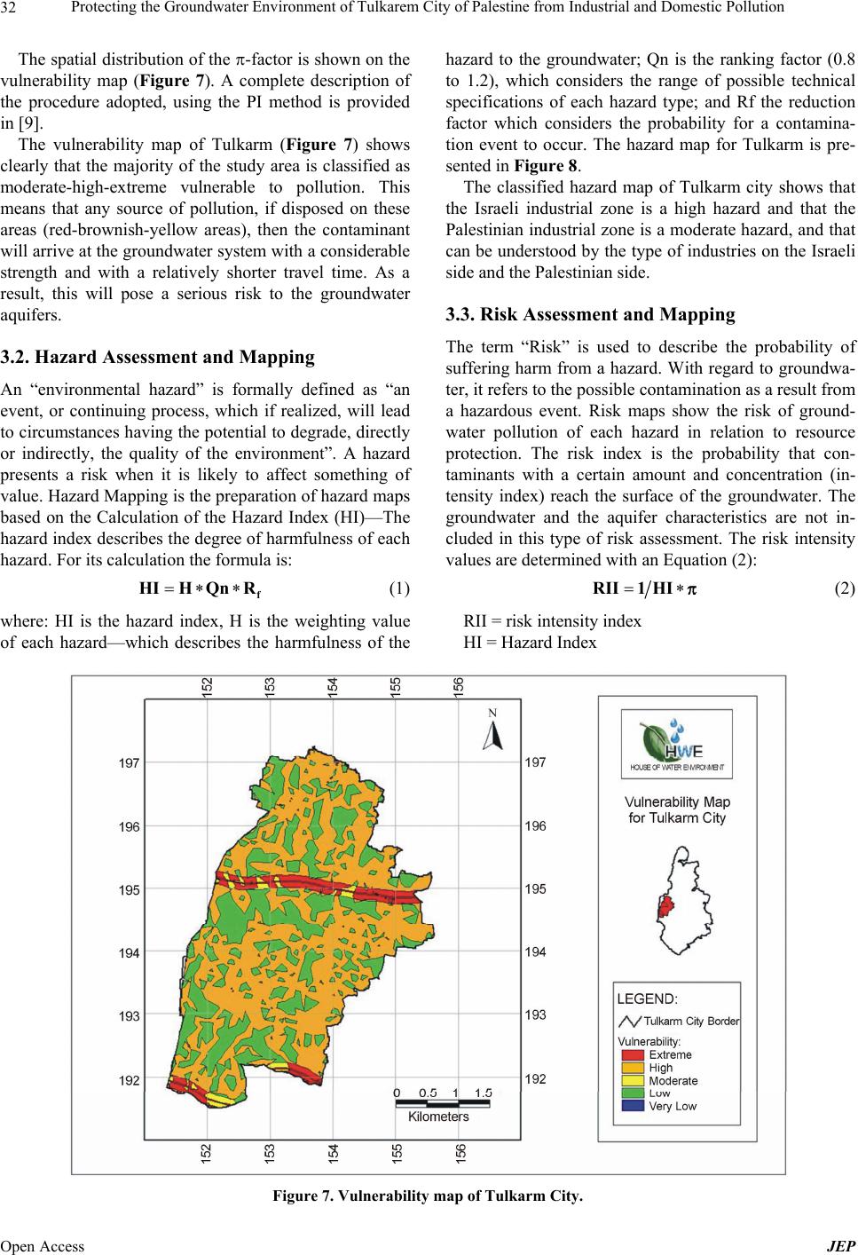
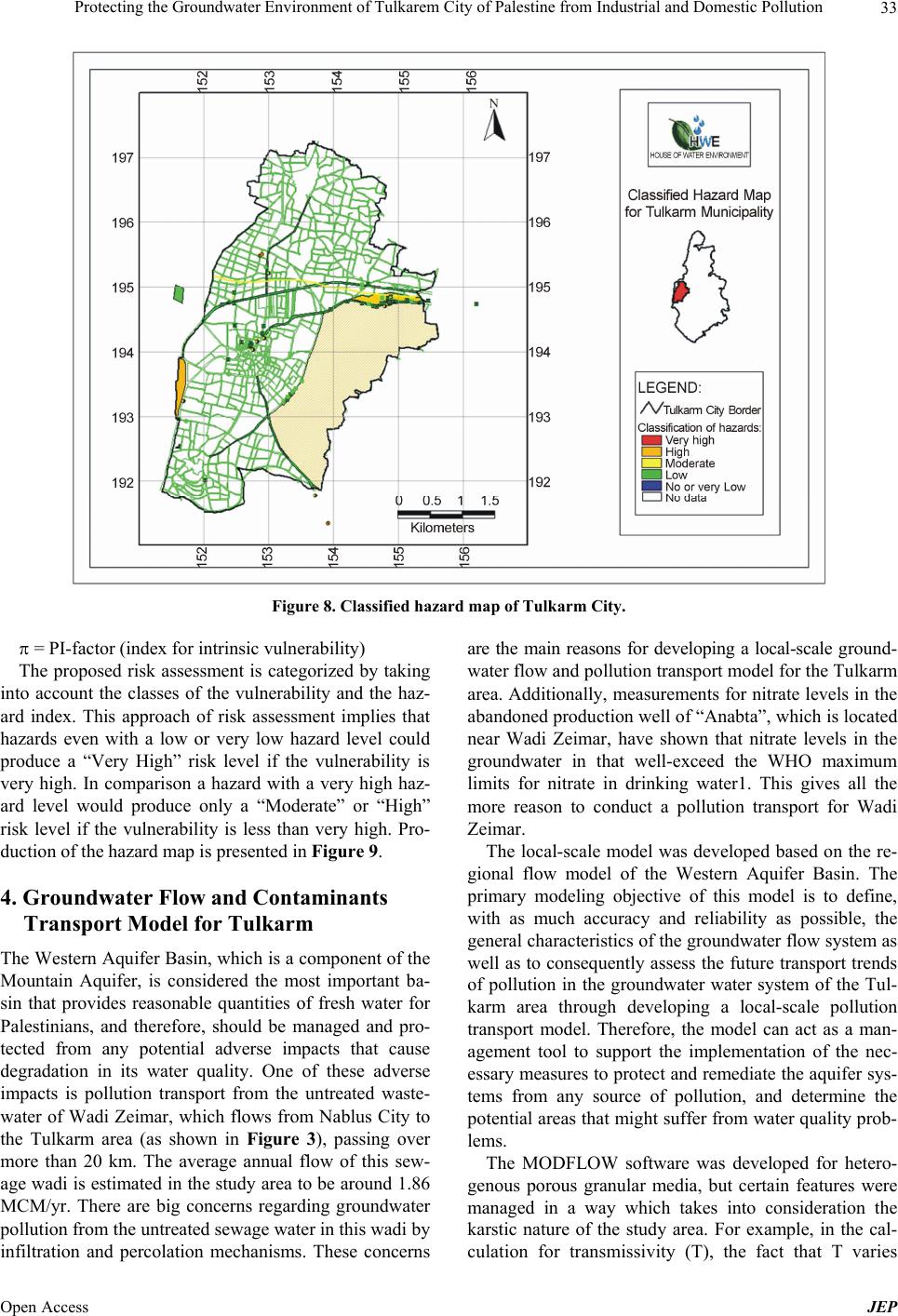
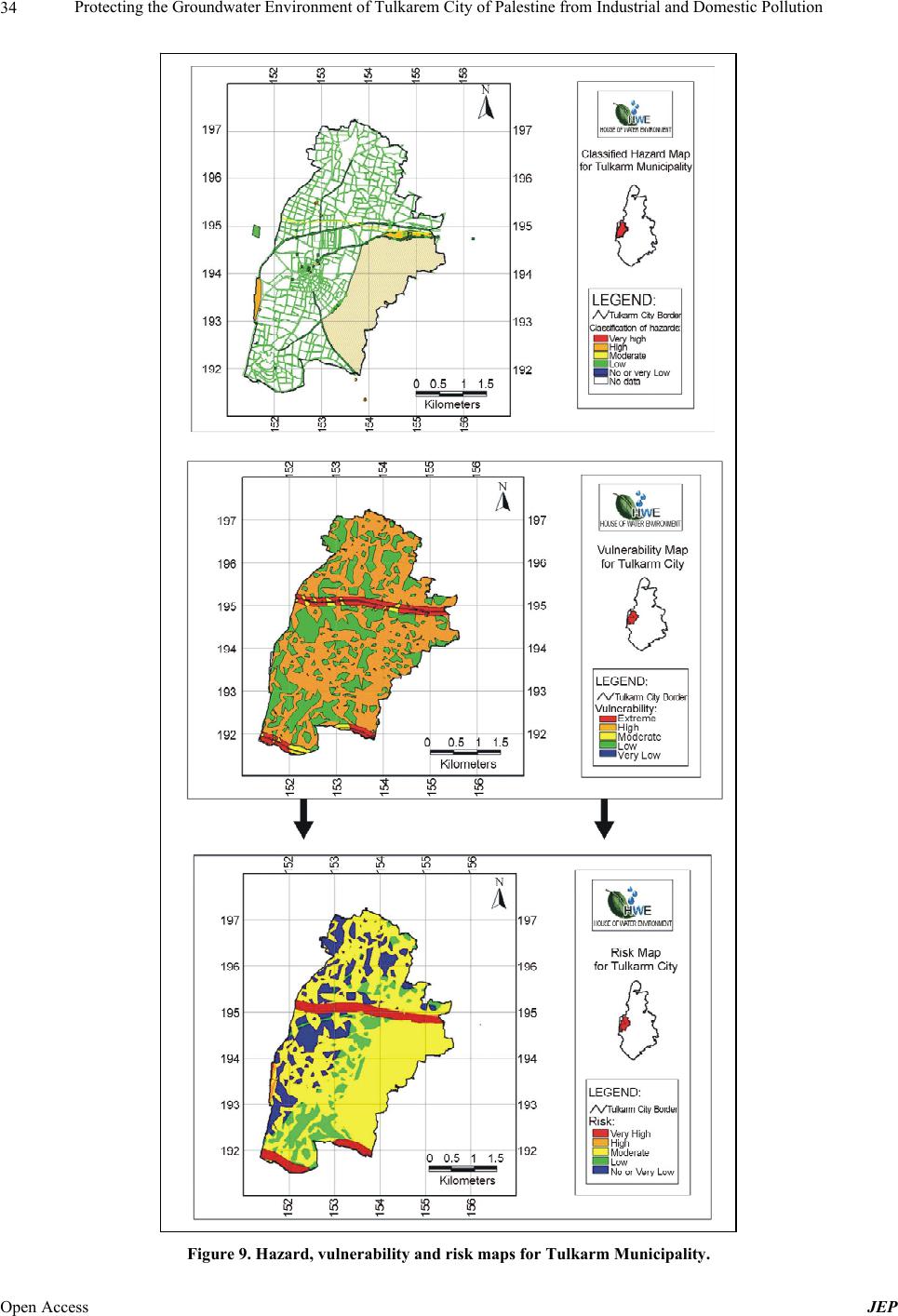
6. Conclusion
This paper has shown the importance of protecting Pales-
tinian water resources from pollution generated by mu-
nicipalities and the importance of effectively managing
these water resources. The general aim of this paper is to
addresses the protection of groundwater resources from
pollution from the unique perspective of local munici-
palities, in an attempt to help municipalities identify pol-
luting activities in their boundaries, as well as develop
policy mechanisms and techniques on preventing ground-
water pollution. The modeling and vulnerability mapping
assessment indicated that Tulkarm is located in a moder-
ate to highly vulnerable area, due to the natural charac-
teristics of the region. Sewage flow in the recharge area
of the Mountain Aquifer leads directly to pollution of
groundwater. Moreover, groundwater in that area is clo-
ser to the surface, requiring a shorter period of time for
pollutants to percolate and reach it. Unfortunately, it is
also the location of some of the most serious pollution
spots. So, these areas are particularly vulnerable to pollu-
tion from sewage, solid waste, agriculture and other
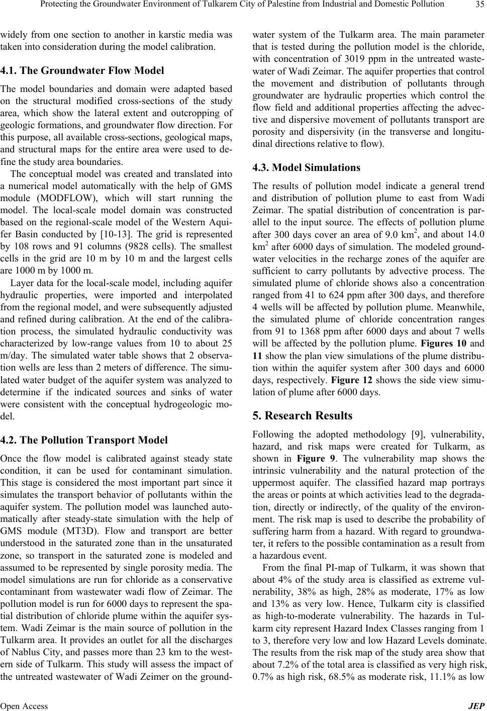
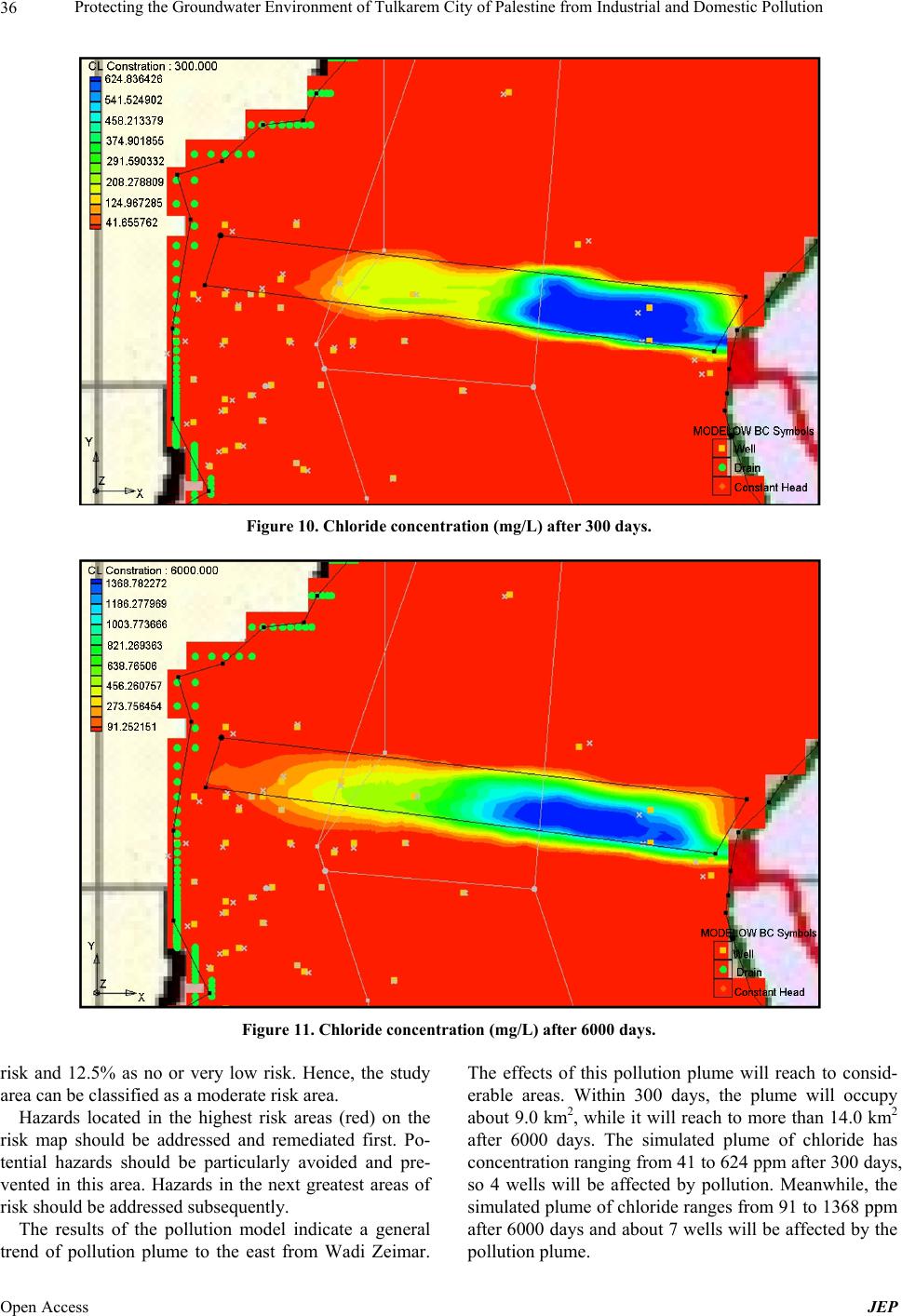
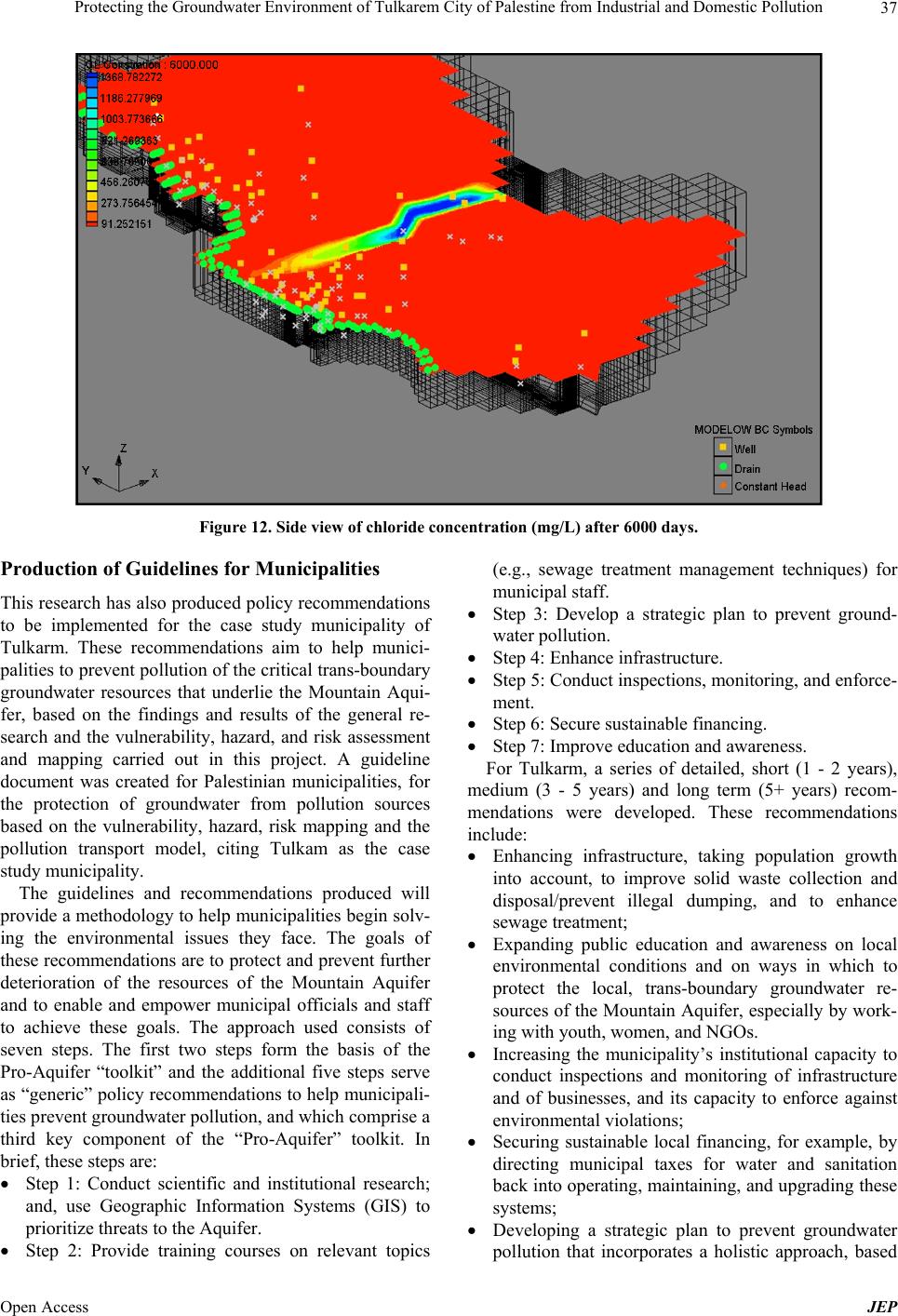
types of pollutants. The results of the pollution modeling
indicate a general significant trend and distribution of a
pollution plume because of raw sewage in wadi Zeimar
in the Tulkarm area. The pollution plume covers 14 km2
in the Tulkarm area after 6000 days of model simulation.
This will affect 7 groundwater wells in the area.
7. Recommendations
The outputs of this paper emphasize the need for more
efforts to protect natural resources from pollution. It is
recommended to take more cases of Palestinian munici-
palities and to study their sources of pollution and how
they impact on the shared groundwater resources. In or-
der for any comprehensive and integrated cooperative
approaches to be successful, it is recommended to con-
struct a comprehensive GIS database for pollution sources
that covers all municipalities. Although data availability
was an important indicator in the selection of the case
study of Tulkarm, once the actual work took place, it was
realized that some substantial data and information were
still needed. It is recommended that reliable data should
be available for all municipalities for future work. Pollu-
tion needs monitoring and real time data in order to alle-
viate its negative impacts on water resources. It is rec-
ommended to investigate one type of pollution (i.e. pol-
lution generated from improper solid waste management
practices), and to install monitoring equipment/structures
to study the degree of pollution and then introduce a so-
lution and use the same monitoring tool in order to see
how much pollution can be alleviated. Groundwater pol-
lution modeling for cities is highly recommended. This
will help investigate the degree of spread of pollution on
one hand and help investigate the effectiveness of any
solution that will be introduced in the future. The scien-
tific research and pollution modeling will help develop
groundwater protection guidelines and/or standards. Both
the results of the research and the groundwater protection
guidelines should establish the material for further train-
ing and capacity building programs for municipalities.
8. Acknowledgments
The House of Water and Environment (HWE) would like
to express their gratitude and appreciation to the Euro-
pean Commission—Environment DG-Life, and Green
Cross-France for the generous support and funding, with-
out which this project would not have been possible.
HWE would also like to thank Friends of the Earth-
Middle East and its team for their efforts.
REFERENCES
[1] Z. Tagar, T. Keinan and G. Bromberg, “A Seeping Time-
bomb: Pollution of the Mountain Aquifer by Sewage,”
Water Resources in the Middle East, Vol. 2, 2007, pp.
417-426. http://dx.doi.org/10.1007/978-3-540-69509-7_42
[2] A. Aliewi, K. Rajab, N. Imseih, J. Abu Sada, L. Freimuth
and A. Saltman, “Protecting Trans-Boundary Groundwa-
ter Sources from Pollution: ‘Research, Training and Guide-
lines for Municipalities’,” House of Water and Environ-
ment, Palestine, and Friends of the Earth-Middle East,
2008.
[3] Central Bureau of Statistics (CBS)-Israel, “Environment
Data Compendium,” No. 2, 2006, pp. 7-9,59-61.
http://www1.cbs.gov.il/www/hodaot2006n/envcompendiu
m.pdf
[4] Central Bureau of Statistics (CBS)-Israel, “Labour Force
Survey of 2006,” No. 1305, 2008.
http://www1.cbs.gov.il/reader/y_labor/yearm_e_new.htm
[5] PCBS, “Projected Mid-Year Population in the Palestinian
Territory by Governorate (2001-2007),” Palestinian Cen-
tral Bureau of Statistics, 2006.
http://www.pcbs.gov.ps/Portals/_pcbs/populati/demd1.aspx
[6] PCBS, “Distribution of Dumping Sites by Environmental
Supervision Availability on the Dumping Site and Gov-
ernorate in the Palestinian Territory,” 2007.
Open Access JEP