Open Journal of Geology, 2013, 3, 46-49
doi:10.4236/ojg.2013.32B011 Published Online April 2013 (http://www.scirp.org/journal/ojg)
Geoelectrical Survey for Engineering Investigation
A. H. A Teh Saufia, Rosli Saad, M.M. Nordiana, I.N. Azwin, Andy A. Bery,
Noer El Hidayah Ismail, Nisa’ Ali, Mark Jinmin, Y.C. Kiu, S.L. Ragu Ragava R.
Geophysics Section, School of Physics, Universiti Sains Malaysia, Penang, Malaysia
Email: teh.saufia@gmail.com
Received 2013
ABSTRACT
Water seepage erosion has been and remains one of the major engineering problems. However, most engineers will
much depend on borehole data and soil test for designing and problem detection. By considering of the cost and de-
structive method, selection of geoelectrical prospecting would be appropriate. Therefore, two electrical geophysical
surveys were carried out in Sekolah Menengah Kebangsaan Dato’ Haji Mohd Nor, Gelugor, Pulau Pinang to map the
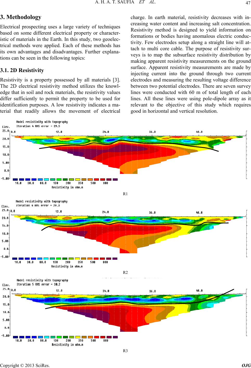
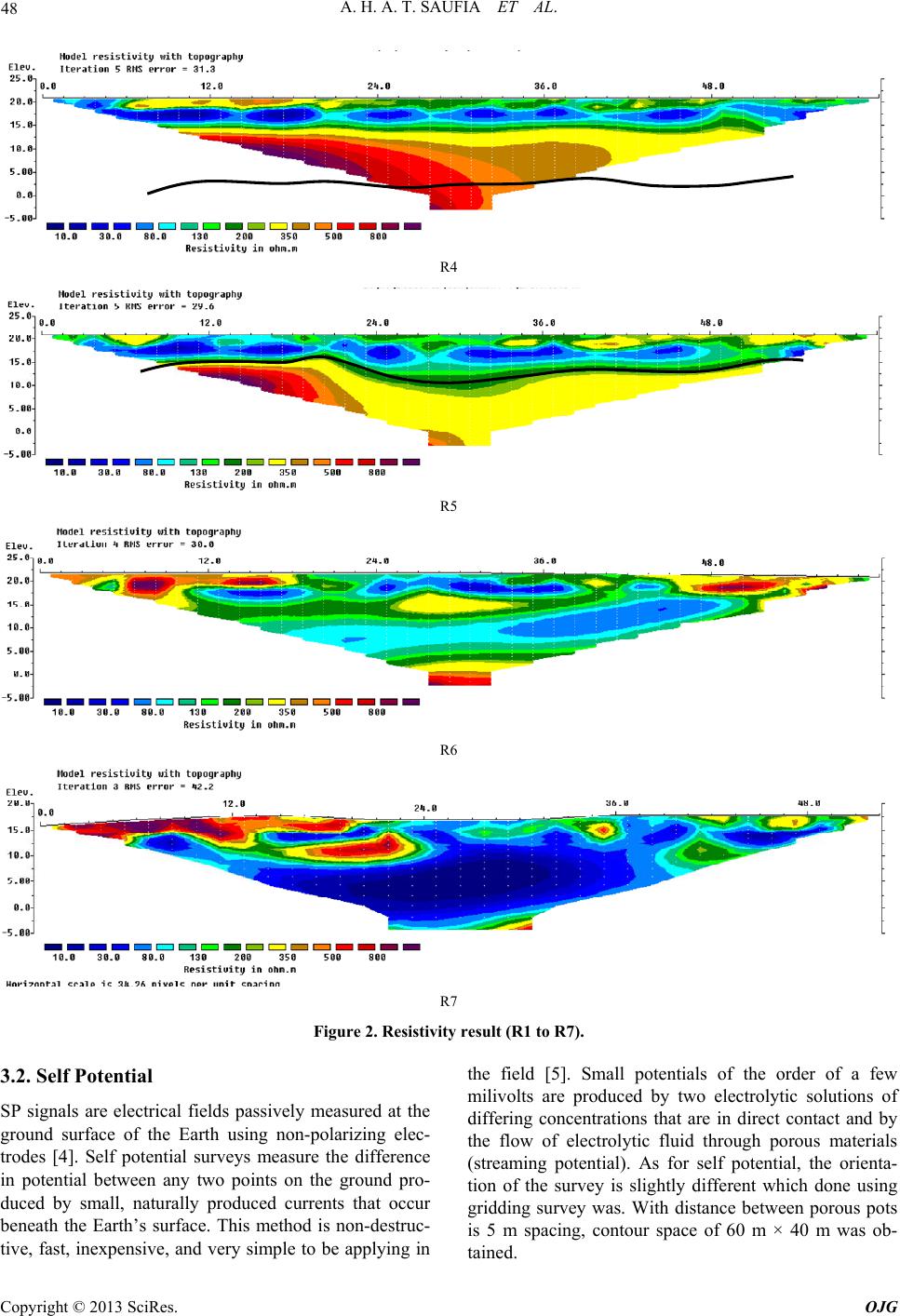
presence of the unknown underground water sources (saturated zones) and its movement. With the total of seven resis-
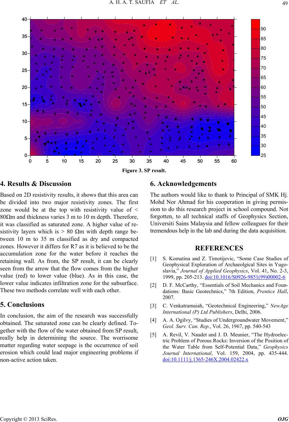
tivity lines parallel to each other and self potential (SP) with 5 m × 5 m gridding survey were successfully done. The
resistivity result from line 1 (R1) to line 6 (R6) shows the subsurface consist of saturated zones with range between 3 m
up to 10 m depth, before it reaches the R7 which is believed as the accumulation zone. Meanwhile, as for SP result it
shows the water flow from higher value (north-east) towards the lower value which is mostly at the south area. In con-
clusion, geoelectrical survey could assist in detecting and solving engineering problems as it proven by the result from
each method.
Keywords: Geoelectrical; 2D Resistivity; Self Potential; Engineering
1. Introduction
Geoelectrical survey is commonly known in environ-
mental or engineering prospecting. Geophysical studies
which provide nondestructive methods have recently
been employed to reduce cost and numerous problems
[1]. With advantages of non-invasive, low cost and fast,
geophysical method always become as a primary solution
in various exploration. One of the common problems
engineering field would be soil erosion due to water
movement either on the surface or beneath the surface. In
general, soil erosion can be defined as one form of soil
degradation along with soil compaction, low organic
matter, loss of soil structure, poor internal drainage,
salinization, and soil acidity problems. Due to the changes
of the properties and behavior of the soil, therefore, it can
influence both construction operations and the perform-
ance of completed construction [2]. Hence, geoelectrical
survey would be appropariate tool as it is most likely
measured the changes of resistivity (or conductivity)
which is one of the most important physical properties of
the rock. In this study, the overflowing of unknown water
sources at the retaining wall has created a tremendous
interest. It is because it could be the factor of water
seepage beneath the subsurface which could leads to
landslide or soil erosion. Hence, this study is aimed to
locate the unknown water source and its movement.
2. Study Area
The survey was conducted at Gelugor, Penang within
SMK Dato Haji Mohd Nor Ahmad’s compound. The
survey was done on the school’s field which was recently
undergoing a piping reconstruction beneath it. During
monitoring and observation session at this area, it pre-
dictably was facing several engineering problems. With
heavy and unstoppable flow of water through retaining
wall which can be clearly seen from the outside of the
school as well as few pools or water puddles on the field
ground, it strengthen the fact that currently experience
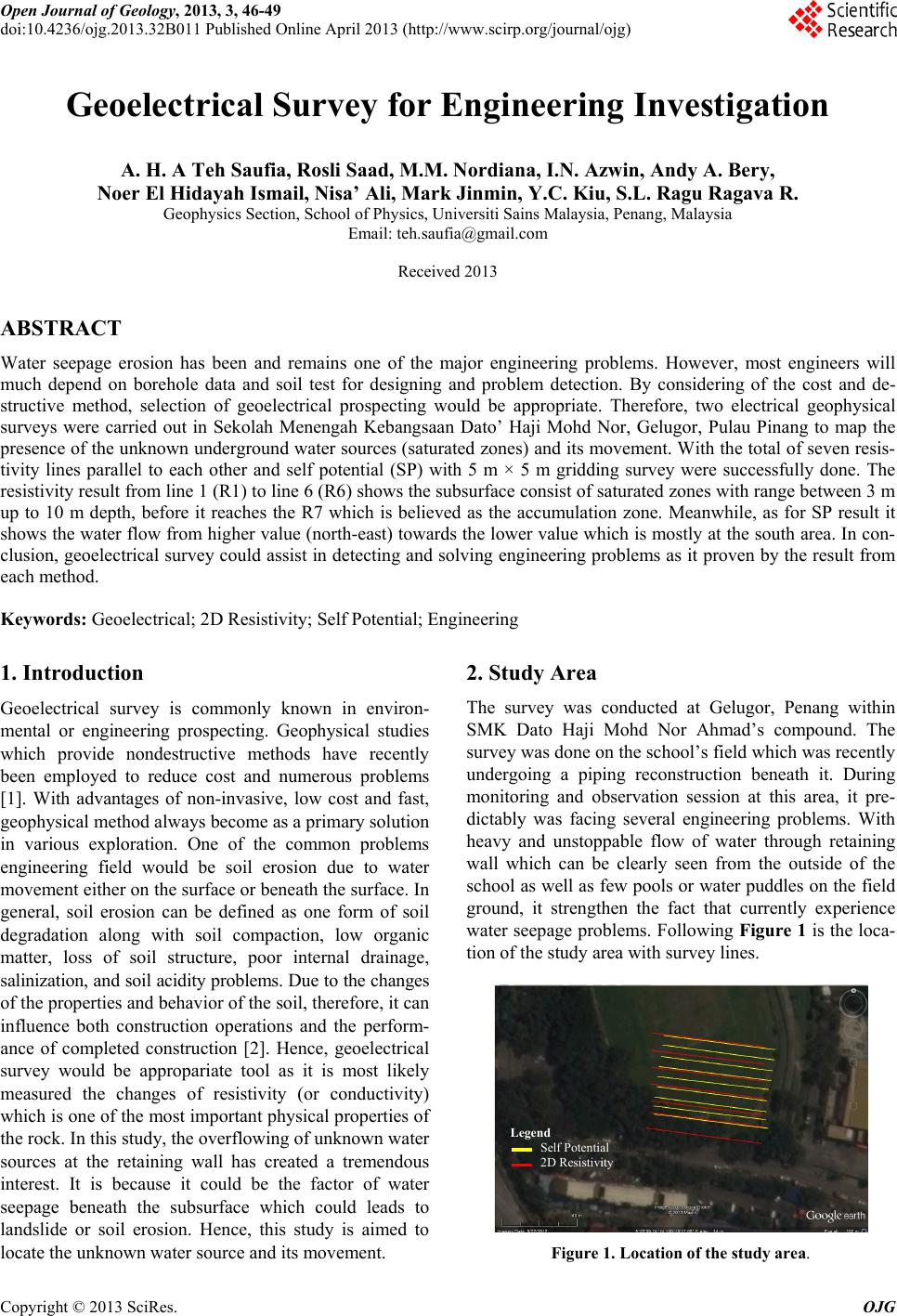
water seepage problems. Following Figure 1 is the loca-
tion of the study area with survey lines.
Legend
Self Potential
2D Resistivity
Figure 1. Location of the study area.
Copyright © 2013 SciRes. OJG