Journal of Geographic Information System, 2010, 2, 177-184
doi:10.4236/jgis.2010.23025 Published Online July 2010 (http://www.SciRP.org/journal/jgis)
Copyright © 2010 SciRes. JGIS
Geospatial Mapping of Singhbhum Shear Zone (SSZ)
with Respect to Mineral Prospecting
Bijay Singh, Jimly Dowerah
University Department of Geology, R anchi University , Ranchi, India
E-mail: bsingh6029@gmail.com, jdowerah@gmail.com
Received January 19, 2010; revised February 25, 2010; accepted March 2, 2010
Abstract
Singhbhum Shear Zone is a highly mineralized zone having variety of minerals, predominantly those of ura-
nium, copper and some sulphide minerals. From Remote Sensing data it is possible to decipher the regional
lithology, tectonic fabric and also the geomorphic details of a terrain which aid precisely in targeting of met-
als and minerals. Mapping of mineralized zones can be done using Geospatial Technology in a GIS platform.
The present study includes creation of various maps like lithological map, geomorphological map, contours
and slope map using satellite data like IRS LISS-IV and ASTER DEM which can be used to interprete and
correlate the various mineral prospective zones in the study area. Even the alterations of the prevalent min-
eral zones can be mapped for further utilization strategies. The present work is based on the investigations
being carried under ISRO-SAC Respond Project (Dept. of Space, Govt. of India SAC Code: OGP62, ISRO
Code: 10/4/556).
Keywords: Singhbhum Shear Zone, Geospatial Mapping, Mineral Prospecting, Alterations, Sulphide Ores
1. Introduction
Mineral Exploration is not only highly imaginative and
creative but a very costly activity as well. Much informa-
tion about potential areas for mineral exploration can be
provided by interpretation of surface features on aerial
photographs and satellite images (Lilesand et al, 2007).
From Remote Sensing data it is possible to decipher the
regional lithology, tectonic fabric and also the geomorp-
hic details of a terrain which aid precisely in targeting of
metals and minerals. Usage of Geospatial Technology has
enhanced the study of mineral exploration as geological
maps can be easily integrated with other important de-
tails like geomorphology, structure, geophysical data etc.
Multispectral image analysis technique in the field of
Geologic remote sensing has proved to be a potential tec-
hnique for the information extraction process. Number of
image analysis techniques are evolved and applied for
optimization of information extraction process.
SSZ represents one of the most spectacular tectonic fe-
atures is occurring in the Singhbhum Craton spread over
Jharkhand and adjoining areas, marks the boundary bet-
ween the two Archaean Cratons of Singhbhum Granite
Batholith and the Iron Ore Group and the Proterozoic Mo-
bile Belt in the north. SSZ is an arcuate belt of 200 km
length and width varying between 1-25 kms. It is one of
the most well known mineral abundan t zones in the cou-
ntry and extensive mineral exploration has been carried
out in this zone since a long time. The Central Indian
Suture or the Satpura Mobile Belt continues across the
Mahanadi fault to form the Northern Boundary of the Si-
nghbhum craton. The mobile belt bends around the cra-
ton to merge with the Eastern Ghats Mobile Belt in the
south. The latter overthrusts th e Singhbhum craton at the
Sukhinda thrust.
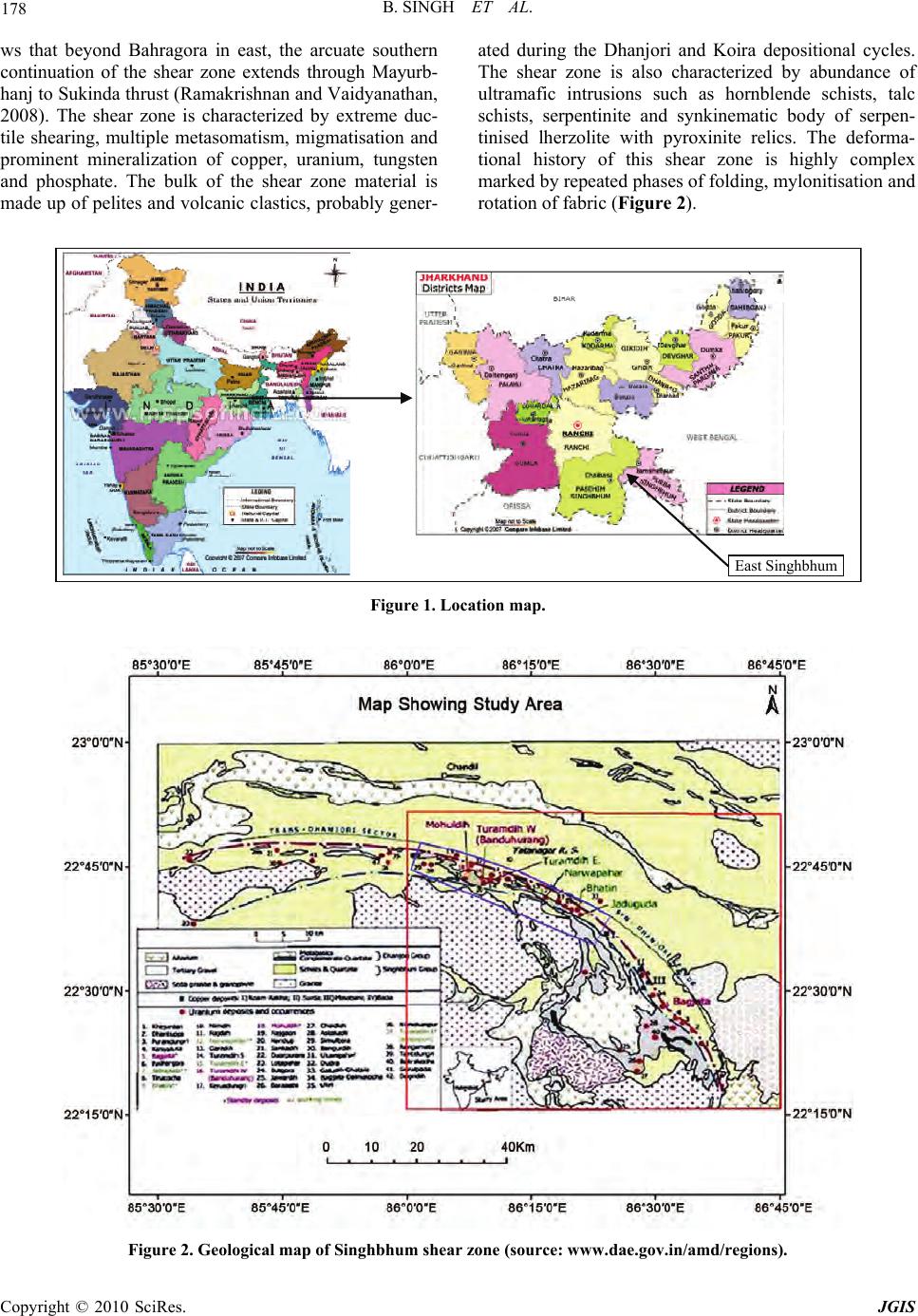
The study area falls in the SSZ and is extended be-
tween Tatanagar (22° 50' N: 86° 10' E) and Bahragora
(22° 16' N: 86° 43' E) in the south east falling mostly in
the Survey of India Toposheet no. J/2, 6, 7, 10 and 11,
confined in th e East Singhbhum of Jhark hand (Figure 1).
The present work involves geospatial mapping of the
study area on a GIS platform by interpreting multispect-
ral satellite imagery.
2. Geological Setting
SSZ is a unique arcuate structure extending from Bahr-
agora in east to Porahat in west. At the extreme west end
it grades into high angle fault and extends upto the west-
ern margin of Bonai granite. Satellite imagery study sho-