Paper Menu >>
Journal Menu >>
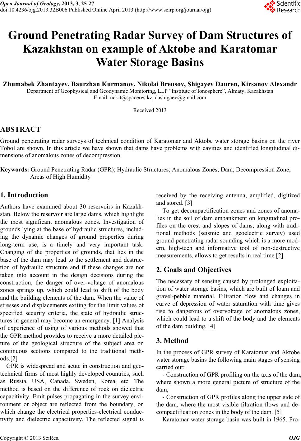 Open Journal of Geology, 2013, 3, 25-27 doi:10.4236/ojg.2013.32B006 Published Online April 2013 (http://www.scirp.org/journal/ojg) Ground Penetrating Radar Survey of Dam Structures of Kazakhstan on example of Aktobe and Karatomar Water Storage Basins Zhumabek Zhantayev, Baurzhan Kurmanov, Nikolai Breusov, Shigayev Dauren, Kirsanov Alexandr Department of Geophysical and Geodynamic Monitoring, LLP “Institute of Ionosphere”, Almaty, Kazakhstan Email: nckit@spaceres.kz, dashigaev@gmail.com Received 2013 ABSTRACT Ground penetrating radar surveys of technical condition of Karatomar and Aktobe water storage basins on the river Tobol are shown. In this article we have shown that dams have problems with cavities and identified longitudinal di- mensions of anomalous zones of decompression. Keywords: Ground Penetrating Radar (GPR); Hydraulic Structures; Anomalous Zones; Dam; Decompression Zone; Areas of High Humidity 1. Introduction Authors have examined about 30 reservoirs in Kazakh- stan. Below the reservoir are large dams, which highlight the most significant anomalous zones. Investigation of grounds lying at the base of hydraulic structures, includ- ing the dynamic changes of ground properties during long-term use, is a timely and very important task. Changing of the properties of grounds, that lies in the base of the dam may lead to the settlement and destruc- tion of hydraulic structure and if these changes are not taken into account in the design decisions during the construction, the danger of over-voltage of anomalous zones springs up, which could lead to shift of the body and the building elements of the dam. When the value of stresses and displacements exiting for the limit values of specified security criteria, the state of hydraulic struc- tures in general may become an emergency. [1] Analysis of experience of using of various methods showed that the GPR method provides to receive a more detailed pic- ture of the geological structure of the subject area on continuous sections compared to the traditional meth- ods.[2] GPR is widespread and acute in construction and geo- technical firms of most highly developed countries, such as Russia, USA, Canada, Sweden, Korea, etc. The method is based on the difference of rock on dielectric capacitivity. Emit pulses propagating in the survey envi- ronment or object are reflected from the boundary, on which change the electrical properties-electrical conduc- tivity and dielectric capacitivity. The reflected signal is received by the receiving antenna, amplified, digitized and stored. [3] To get decompactification zones and zones of anoma- lies in the soil of dam embankment on longitudinal pro- files on the crest and slopes of dams, along with tradi- tional methods (seismic and geoelectric survey) used ground penetrating radar sounding which is a more mod- ern, high-tech and informative tool of non-destructive measurements, allows to get results in real time [2]. 2. Goals and Objectives The necessary of sensing caused by prolonged exploita- tion of water storage basins, which are built of loam and gravel-pebble material. Filtration flow and changes in curve of depression of water saturation with time gives rise to dangerous of overvoltage of anomalous zones, which could lead to a shift of the body and the elements of the dam building. [4] 3. Method In the process of GPR survey of Karatomar and Aktobe water storage basins the following main stages of sensing carried out: - Construction of GPR profiling on the axis of the dam, where shown a more general picture of structure of the dam; - Construction of GPR profiles along the upper side of the dam, where the most visible filtration flows and de- compactification zones in the body of the dam. [5] Karatomar water storage basin was built in 1965. Pro- Copyright © 2013 SciRes. OJG 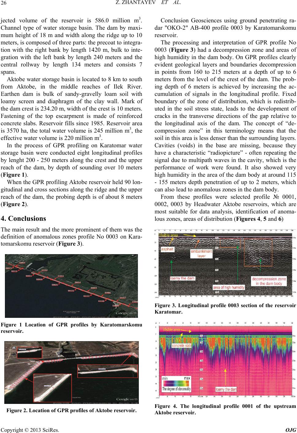 Z. ZHANTAYEV ET AL. 26 jected volume of the reservoir is 586.0 million m3. Channel type of water storage basin. The dam by maxi- mum height of 18 m and width along the ridge up to 10 meters, is composed of three parts: the precoat to integra- tion with the right bank by length 1420 m, bulk to inte- gration with the left bank by length 240 meters and the central rollway by length 134 meters and consists 7 spans. Aktobe water storage basin is located to 8 km to south from Aktobe, in the middle reaches of Ilek River. Earthen dam is bulk of sandy-gravelly loam soil with loamy screen and diaphragm of the clay wall. Mark of the dam crest is 234.20 m, width of the crest is 10 meters. Fastening of the top escarpment is made of reinforced concrete slabs. Reservoir fills since 1985. Reservoir area is 3570 ha, the total water volume is 245 million m3, the effective water volume is 220 million m3. In the process of GPR profiling on Karatomar water storage basin were conducted eight longitudinal profiles by lenght 200 - 250 meters along the crest and the upper reach of the dam, by depth of sounding over 10 meters (Figure 1). When the GPR profiling Aktobe reservoir held 90 lon- gitudinal and cross sections along the ridge and the upper reach of the dam, the probing depth is of about 8 meters (Figure 2). 4. Conclusions The main result and the more prominent of them was the definition of anomalous zones profile No 0003 on Kara- tomarskomu reservoir (Figure 3). Figure 1 Location of GPR profiles by Karatomarskomu reservoir. Figure 2. Location of GPR profiles of Aktobe reservoir. Conclusion Geosciences using ground penetrating ra- dar "OKO-2" AB-400 profile 0003 by Karatomarskomu reservoir. The processing and interpretation of GPR profile No 0003 (Figure 3) had a decompression zone and areas of high humidity in the dam body. On GPR profiles clearly evident geological layers and boundaries decompression in points from 160 to 215 meters at a depth of up to 6 meters from the level of the crest of the dam. The prob- ing depth of 6 meters is achieved by increasing the ac- cumulation of signals in the longitudinal profile. Fixed boundary of the zone of distribution, which is redistrib- uted in the soil stress state, leads to the development of cracks in the transverse directions of the gap relative to the longitudinal axis of the dam. The concept of “de- compression zone” in this terminology means that the soil in this area is less denser than the surrounding layers. Cavities (voids) in the base are missing, because they have a characteristic “radiopicture” - often repeating the signal due to multipath waves in the cavity, which is the performance of work were found. It also showed very high humidity in the area of the dam body at around 115 - 155 meters depth penetration of up to 2 meters, which can also lead to anomalous zones in the dam body. From these profiles were selected profile № 0001, 0002, 0003 by Headwater Aktobe reservoirs, which are most suitable for data analysis, identification of anoma- lous zones, areas of distribution (Figures 4, 5 and 6) Figure 3. Longitudinal profile 0003 section of the reservoir Karatomar. Figure 4. The longitudinal profile 0001 of the upstream Aktobe reservoir. Copyright © 2013 SciRes. OJG 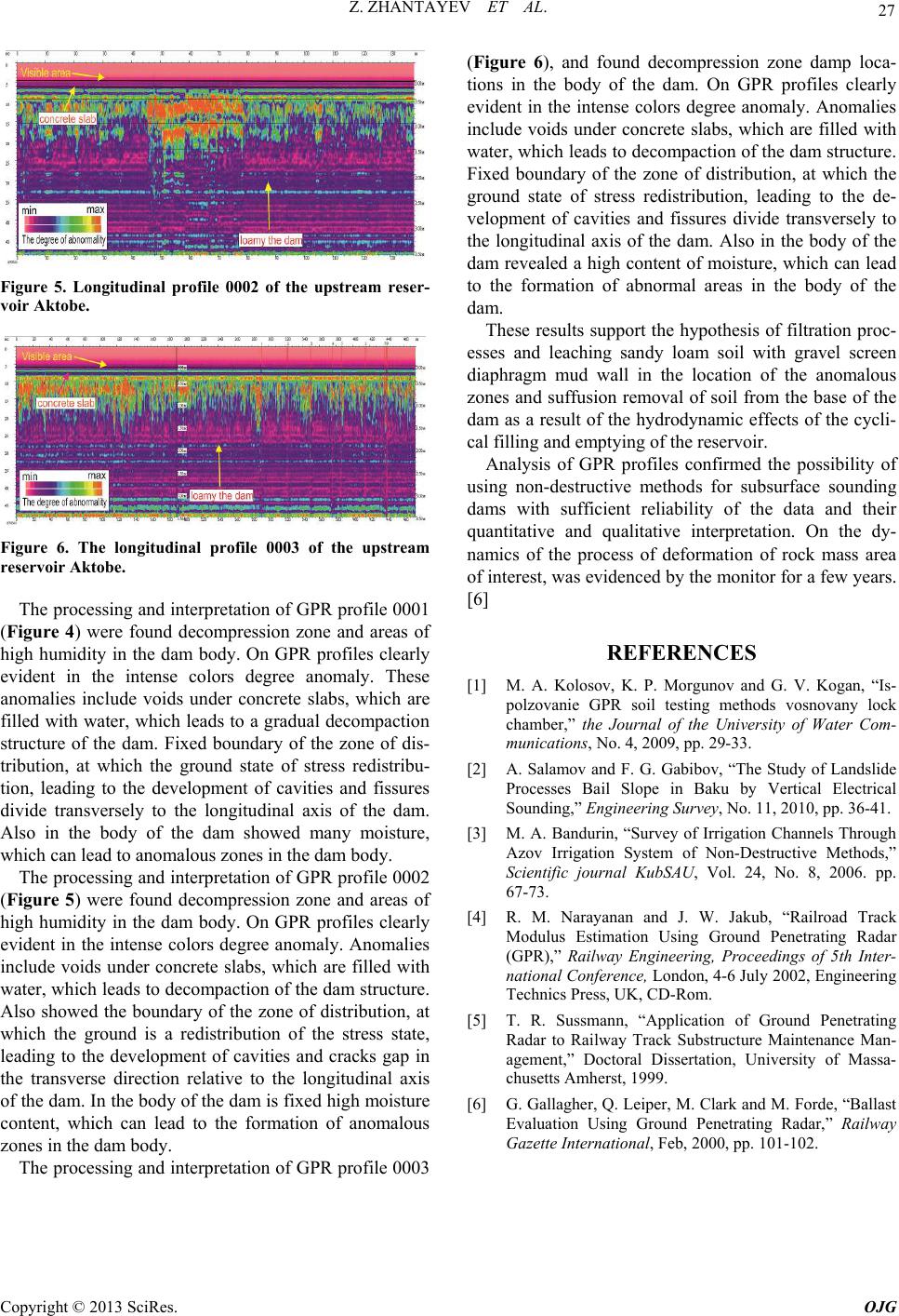 Z. ZHANTAYEV ET AL. Copyright © 2013 SciRes. OJG 27 Figure 5. Longitudinal profile 0002 of the upstream reser- voir Aktobe. Figure 6. The longitudinal profile 0003 of the upstream reservoir Aktobe. The processing and interpretation of GPR profile 0001 (Figure 4) were found decompression zone and areas of high humidity in the dam body. On GPR profiles clearly evident in the intense colors degree anomaly. These anomalies include voids under concrete slabs, which are filled with water, which leads to a gradual decompaction structure of the dam. Fixed boundary of the zone of dis- tribution, at which the ground state of stress redistribu- tion, leading to the development of cavities and fissures divide transversely to the longitudinal axis of the dam. Also in the body of the dam showed many moisture, which can lead to anomalous zones in the dam body. The processing and interpretation of GPR profile 0002 (Figure 5) were found decompression zone and areas of high humidity in the dam body. On GPR profiles clearly evident in the intense colors degree anomaly. Anomalies include voids under concrete slabs, which are filled with water, which leads to decompaction of the dam structure. Also showed the boundary of the zone of distribution, at which the ground is a redistribution of the stress state, leading to the development of cavities and cracks gap in the transverse direction relative to the longitudinal axis of the dam. In the body of the dam is fixed high moisture content, which can lead to the formation of anomalous zones in the dam body. The processing and interpretation of GPR profile 0003 (Figure 6), and found decompression zone damp loca- tions in the body of the dam. On GPR profiles clearly evident in the intense colors degree anomaly. Anomalies include voids under concrete slabs, which are filled with water, which leads to decompaction of the dam structure. Fixed boundary of the zone of distribution, at which the ground state of stress redistribution, leading to the de- velopment of cavities and fissures divide transversely to the longitudinal axis of the dam. Also in the body of the dam revealed a high content of moisture, which can lead to the formation of abnormal areas in the body of the dam. These results support the hypothesis of filtration proc- esses and leaching sandy loam soil with gravel screen diaphragm mud wall in the location of the anomalous zones and suffusion removal of soil from the base of the dam as a result of the hydrodynamic effects of the cycli- cal filling and emptying of the reservoir. Analysis of GPR profiles confirmed the possibility of using non-destructive methods for subsurface sounding dams with sufficient reliability of the data and their quantitative and qualitative interpretation. On the dy- namics of the process of deformation of rock mass area of interest, was evidenced by the monitor for a few years. [6] REFERENCES [1] M. A. Kolosov, K. P. Morgunov and G. V. Kogan, “Is- polzovanie GPR soil testing methods vosnovany lock chamber,” the Journal of the University of Water Com- munications, No. 4, 2009, pp. 29-33. [2] A. Salamov and F. G. Gabibov, “The Study of Landslide Processes Bail Slope in Baku by Vertical Electrical Sounding,” Engineering Survey, No. 11, 2010, pp. 36-41. [3] M. A. Bandurin, “Survey of Irrigation Channels Through Azov Irrigation System of Non-Destructive Methods,” Scientific journal KubSAU, Vol. 24, No. 8, 2006. pp. 67-73. [4] R. M. Narayanan and J. W. Jakub, “Railroad Track Modulus Estimation Using Ground Penetrating Radar (GPR),” Railway Engineering, Proceedings of 5th Inter- national Conference, London, 4-6 July 2002, Engineering Technics Press, UK, CD-Rom. [5] T. R. Sussmann, “Application of Ground Penetrating Radar to Railway Track Substructure Maintenance Man- agement,” Doctoral Dissertation, University of Massa- chusetts Amherst, 1999. [6] G. Gallagher, Q. Leiper, M. Clark and M. Forde, “Ballast Evaluation Using Ground Penetrating Radar,” Railway Gazette International, Feb, 2000, pp. 101-102. |