Paper Menu >>
Journal Menu >>
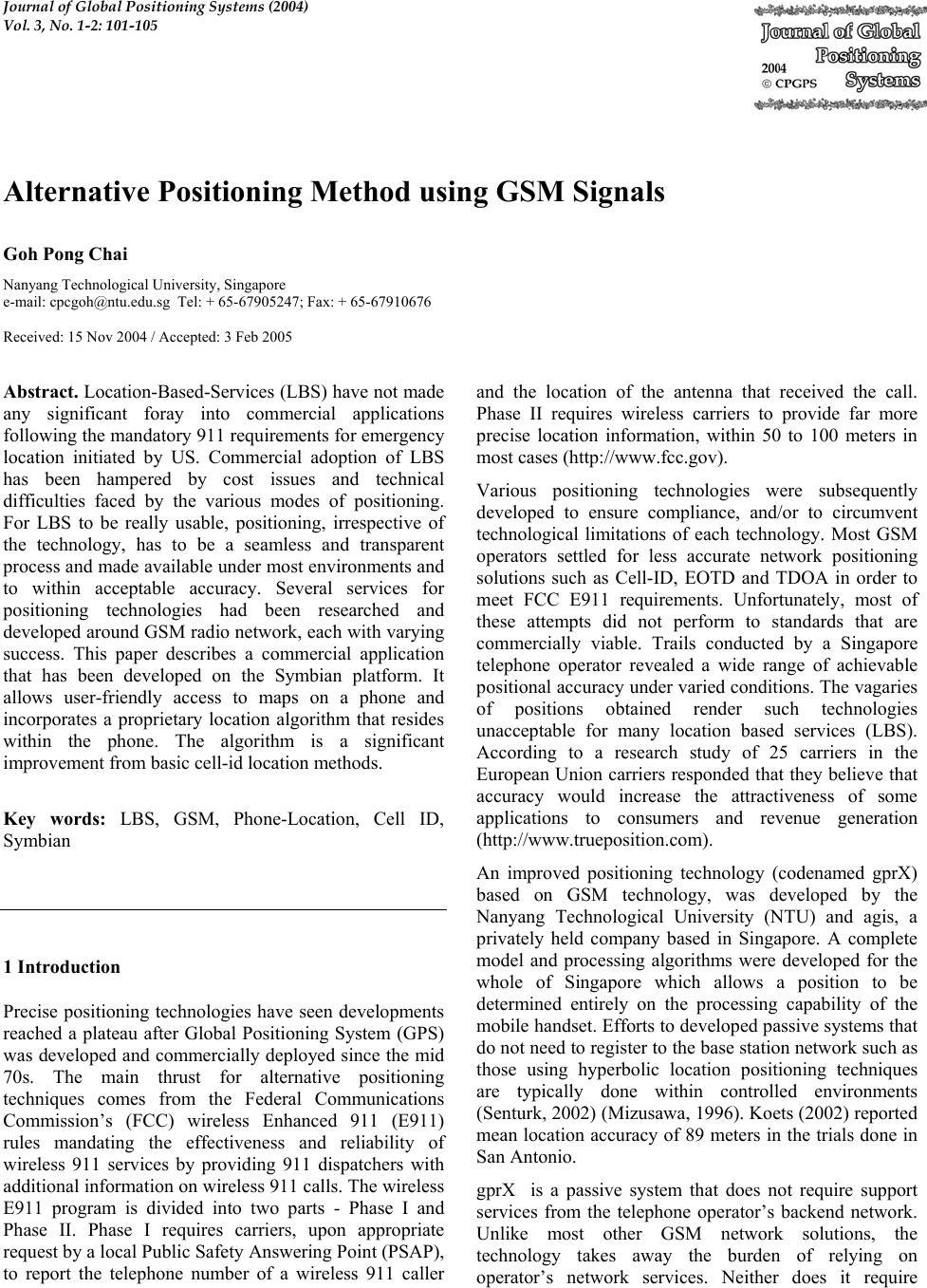 Journal of Global Positioning Systems (2004) Vol. 3, No. 1-2: 101-105 Alternative Positioning Method using GSM Signals Goh Pong Chai Nanyang Technological University, Singapore e-mail: cpcgoh@ntu.edu.sg Tel: + 65-67905247; Fax: + 65-67910676 Received: 15 Nov 2004 / Accepted: 3 Feb 2005 Abstract. Location-Based-Services (LBS) have not made any significant foray into commercial applications following the mandatory 911 requirements for emergency location initiated by US. Commercial adoption of LBS has been hampered by cost issues and technical difficulties faced by the various modes of positioning. For LBS to be really usable, positioning, irrespective of the technology, has to be a seamless and transparent process and made available under most environments and to within acceptable accuracy. Several services for positioning technologies had been researched and developed around GSM radio network, each with varying success. This paper describes a commercial application that has been developed on the Symbian platform. It allows user-friendly access to maps on a phone and incorporates a proprietary location algorithm that resides within the phone. The algorithm is a significant improvement from basic cell-id location methods. Key words: LBS, GSM, Phone-Location, Cell ID, Symbian 1 Introduction Precise positioning technologies have seen developments reached a plateau after Global Positioning System (GPS) was developed and commercially deployed since the mid 70s. The main thrust for alternative positioning techniques comes from the Federal Communications Commission’s (FCC) wireless Enhanced 911 (E911) rules mandating the effectiveness and reliability of wireless 911 services by providing 911 dispatchers with additional information on wireless 911 calls. The wireless E911 program is divided into two parts - Phase I and Phase II. Phase I requires carriers, upon appropriate request by a local Public Safety Answering Point (PSAP), to report the telephone number of a wireless 911 caller and the location of the antenna that received the call. Phase II requires wireless carriers to provide far more precise location information, within 50 to 100 meters in most cases (http://www.fcc.gov). Various positioning technologies were subsequently developed to ensure compliance, and/or to circumvent technological limitations of each technology. Most GSM operators settled for less accurate network positioning solutions such as Cell-ID, EOTD and TDOA in order to meet FCC E911 requirements. Unfortunately, most of these attempts did not perform to standards that are commercially viable. Trails conducted by a Singapore telephone operator revealed a wide range of achievable positional accuracy under varied conditions. The vagaries of positions obtained render such technologies unacceptable for many location based services (LBS). According to a research study of 25 carriers in the European Union carriers responded that they believe that accuracy would increase the attractiveness of some applications to consumers and revenue generation (http://www.trueposition.com). An improved positioning technology (codenamed gprX) based on GSM technology, was developed by the Nanyang Technological University (NTU) and agis, a privately held company based in Singapore. A complete model and processing algorithms were developed for the whole of Singapore which allows a position to be determined entirely on the processing capability of the mobile handset. Efforts to developed passive systems that do not need to register to the base station network such as those using hyperbolic location positioning techniques are typically done within controlled environments (Senturk, 2002) (Mizusawa, 1996). Koets (2002) reported mean location accuracy of 89 meters in the trials done in San Antonio. gprX is a passive system that does not require support services from the telephone operator’s backend network. Unlike most other GSM network solutions, the technology takes away the burden of relying on operator’s network services. Neither does it require 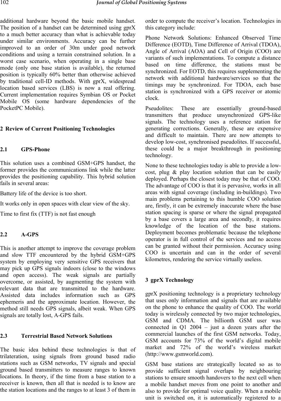 102 Journal of Global Positioning Systems additional hardware beyond the basic mobile handset. The position of a handset can be determined using gprX to a much better accuracy than what is achievable today under similar environments. Accuracy can be further improved to an order of 30m under good network conditions and using a terrain constrained solution. In a worst case scenario, when operating in a single base mode (only one base station is available), the returned position is typically 60% better than otherwise achieved by traditional cell-ID methods. With gprX, widespread location based services (LBS) is now a real offering. Current implementation requires Symbian OS or Pocket Mobile OS (some hardware dependencies of the PocketPC Mobile). 2 Review of Current Positioning Technologies 2.1 GPS-Phone This solution uses a combined GSM+GPS handset, the former provides the communications link while the latter provides the positioning capability. This hybrid solution fails in several areas: Battery life of the device is too short. It works only in open spaces with clear view of the sky. Time to first fix (TTF) is not fast enough 2.2 A-GPS This is another attempt to improve the coverage problem and slow TTF encountered by the hybrid GSM+GPS system by employing very sensitive GPS receivers that may pick up GPS signals indoors (close to the windows and open access). The weak signals are partially overcome, or assisted, by augmenting the system with relevant data that are transmitted to the hardware. Assisted data includes information such as GPS ephemeris and the approximate location. However, the method still needs GPS signals, albeit weak. When GPS signals are totally lost, A-GPS fails. 2.3 Terrestrial Based Network Solutions The basic idea behind these technologies is that of trilateration, using signals from ground based radio stations such as GSM networks, TV signals and special ground based transmitters to measure ranges to known locations. In theory, if the time from a base station to a receiver is known, then all that is needed is to know are the station locations and the ranges to at least 3 of them in order to compute the receiver’s location. Technologies in this category include: Phone Network Solutions: Enhanced Observed Time Difference (EOTD), Time Difference of Arrival (TDOA), Angle of Arrival (AOA) and Cell of Origin (COO) are variants of such implementations. To compute a distance based on time difference, the stations must be synchronized. For EOTD, this requires supplementing the network with additional hardware/services so that the timings may be synchronized. For TDOA, each base station is synchronized with a GPS receiver or atomic clock. Pseudolites: These are essentially ground-based transmitters that produce unsynchronized GPS-like signals. The technology uses a reference station for generating corrections. Generally, these are expensive and difficult to maintain. There are now attempts to develop low-cost, synchronised pseudolites. If successful, these could be a major breakthrough in positioning technology. None to these technologies today is able to provide a low- cost, plug & play location solution that can be easily deployed. Perhaps the closest today may be that of COO. The advantage of COO is that it is pervasive, works in all areas with signal coverage (including in-buildings). Two main problems pertaining to this humble COO solution are, firstly, it can be extremely inaccurate where the base station spacing is sparse or where the signal propagated by a base covers a large area and secondly, it requires knowledge of the location of the base stations. Deployment becomes problematic because the telephone operator is in full control of the services and no access can be granted without their permission. Accuracy using COO is uncertain and can in the order of several kilometres, rendering the service virtually useless. 3 gprX Technology gprX positioning technology is a proprietary technology that uses only information and signals that are available on the phone to enhance the quality of COO. The world today is wirelessly connected by two major technologies, GSM and CDMA. The billionth GSM user was connected in Q1 2004 – just a dozen years after the commercial launches of the first GSM networks. Today, GSM accounts for 73% of the world’s digital mobile market and 72% of the world’s wireless market (http://www.gsmworld.com). GSM base stations are strategically located so as to provide sufficient signal overlaps by neighbouring stations to ensure smooth handovers to the next cell when a mobile handset moves from one point to another and also to provide for optimal voice quality. When a mobile unit is switched on, it is automatically registered to a 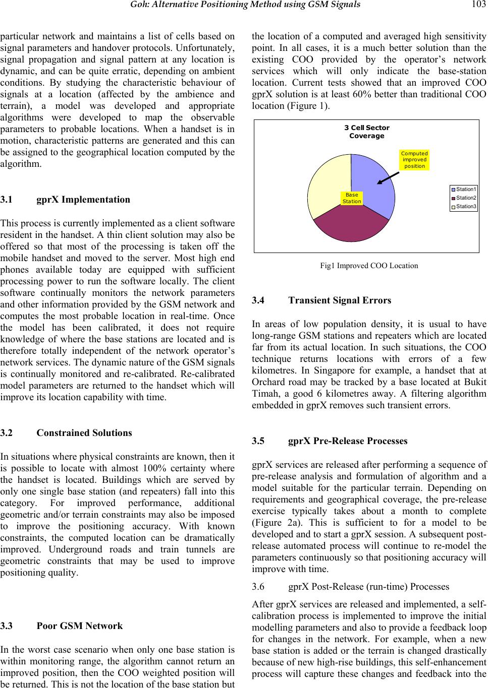 Goh: Alternative Positioning Method using GSM Signals 103 particular network and maintains a list of cells based on signal parameters and handover protocols. Unfortunately, signal propagation and signal pattern at any location is dynamic, and can be quite erratic, depending on ambient conditions. By studying the characteristic behaviour of signals at a location (affected by the ambience and terrain), a model was developed and appropriate algorithms were developed to map the observable parameters to probable locations. When a handset is in motion, characteristic patterns are generated and this can be assigned to the geographical location computed by the algorithm. 3.1 gprX Implementation This process is currently implemented as a client software resident in the handset. A thin client solution may also be offered so that most of the processing is taken off the mobile handset and moved to the server. Most high end phones available today are equipped with sufficient processing power to run the software locally. The client software continually monitors the network parameters and other information provided by the GSM network and computes the most probable location in real-time. Once the model has been calibrated, it does not require knowledge of where the base stations are located and is therefore totally independent of the network operator’s network services. The dynamic nature of the GSM signals is continually monitored and re-calibrated. Re-calibrated model parameters are returned to the handset which will improve its location capability with time. 3.2 Constrained Solutions In situations where physical constraints are known, then it is possible to locate with almost 100% certainty where the handset is located. Buildings which are served by only one single base station (and repeaters) fall into this category. For improved performance, additional geometric and/or terrain constraints may also be imposed to improve the positioning accuracy. With known constraints, the computed location can be dramatically improved. Underground roads and train tunnels are geometric constraints that may be used to improve positioning quality. 3.3 Poor GSM Network In the worst case scenario when only one base station is within monitoring range, the algorithm cannot return an improved position, then the COO weighted position will be returned. This is not the location of the base station but the location of a computed and averaged high sensitivity point. In all cases, it is a much better solution than the existing COO provided by the operator’s network services which will only indicate the base-station location. Current tests showed that an improved COO gprX solution is at least 60% better than traditional COO location (Figure 1). 3 Cell Sector Coverage Station1 Station2 Station3 Computed imp r oved position Ba se Station Fig1 Improved COO Location 3.4 Transient Signal Errors In areas of low population density, it is usual to have long-range GSM stations and repeaters which are located far from its actual location. In such situations, the COO technique returns locations with errors of a few kilometres. In Singapore for example, a handset that at Orchard road may be tracked by a base located at Bukit Timah, a good 6 kilometres away. A filtering algorithm embedded in gprX removes such transient errors. 3.5 gprX Pre-Release Processes gprX services are released after performing a sequence of pre-release analysis and formulation of algorithm and a model suitable for the particular terrain. Depending on requirements and geographical coverage, the pre-release exercise typically takes about a month to complete (Figure 2a). This is sufficient to for a model to be developed and to start a gprX session. A subsequent post- release automated process will continue to re-model the parameters continuously so that positioning accuracy will improve with time. 3.6 gprX Post-Release (run-time) Processes After gprX services are released and implemented, a self- calibration process is implemented to improve the initial modelling parameters and also to provide a feedback loop for changes in the network. For example, when a new base station is added or the terrain is changed drastically because of new high-rise buildings, this self-enhancement process will capture these changes and feedback into the 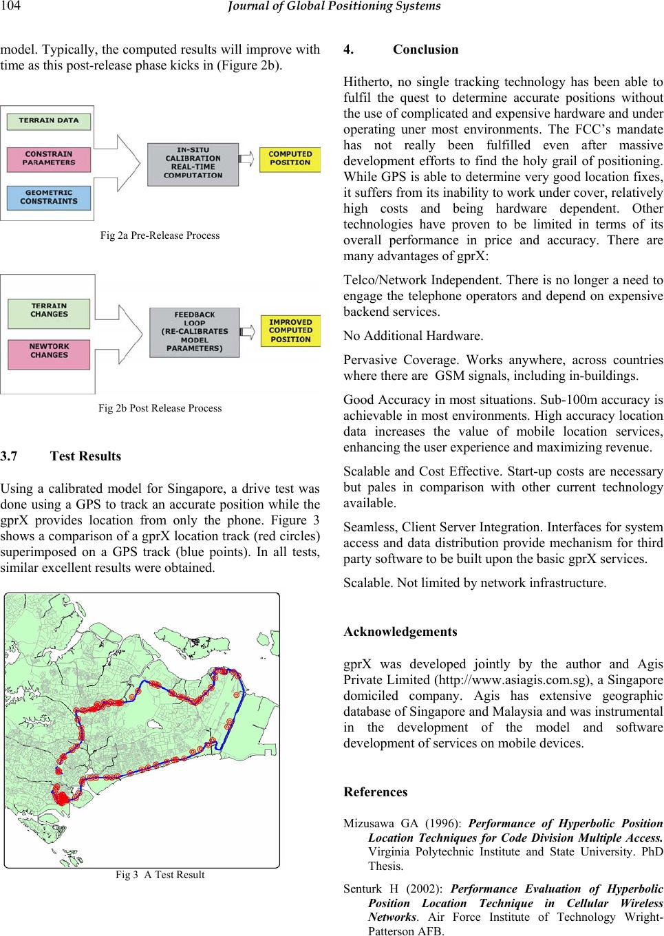 104 Journal of Global Positioning Systems model. Typically, the computed results will improve with time as this post-release phase kicks in (Figure 2b). Fig 2a Pre-Release Process Fig 2b Post Release Process 3.7 Test Results Using a calibrated model for Singapore, a drive test was done using a GPS to track an accurate position while the gprX provides location from only the phone. Figure 3 shows a comparison of a gprX location track (red circles) superimposed on a GPS track (blue points). In all tests, similar excellent results were obtained. Fig 3 A Test Result 4. Conclusion Hitherto, no single tracking technology has been able to fulfil the quest to determine accurate positions without the use of complicated and expensive hardware and under operating uner most environments. The FCC’s mandate has not really been fulfilled even after massive development efforts to find the holy grail of positioning. While GPS is able to determine very good location fixes, it suffers from its inability to work under cover, relatively high costs and being hardware dependent. Other technologies have proven to be limited in terms of its overall performance in price and accuracy. There are many advantages of gprX: Telco/Network Independent. There is no longer a need to engage the telephone operators and depend on expensive backend services. No Additional Hardware. Pervasive Coverage. Works anywhere, across countries where there are GSM signals, including in-buildings. Good Accuracy in most situations. Sub-100m accuracy is achievable in most environments. High accuracy location data increases the value of mobile location services, enhancing the user experience and maximizing revenue. Scalable and Cost Effective. Start-up costs are necessary but pales in comparison with other current technology available. Seamless, Client Server Integration. Interfaces for system access and data distribution provide mechanism for third party software to be built upon the basic gprX services. Scalable. Not limited by network infrastructure. Acknowledgements gprX was developed jointly by the author and Agis Private Limited (http://www.asiagis.com.sg), a Singapore domiciled company. Agis has extensive geographic database of Singapore and Malaysia and was instrumental in the development of the model and software development of services on mobile devices. References Mizusawa GA (1996): Performance of Hyperbolic Position Location Techniques for Code Division Multiple Access. Virginia Polytechnic Institute and State University. PhD Thesis. Senturk H (2002): Performance Evaluation of Hyperbolic Position Location Technique in Cellular Wireless Networks. Air Force Institute of Technology Wright- Patterson AFB.  Goh: Alternative Positioning Method using GSM Signals 105 Koets MA (2002): Development of Inverse Hyperbolic Positioning Using the GSM Cellular Telephone Network. Southwest Research Institute, 16-9222. Reference web-sites: http://www.trueposition.com: (2004) U.S. Poised to Capitalize on Location Services, White Paper http://www.fcc.gov http://www.gsmworld.com |